
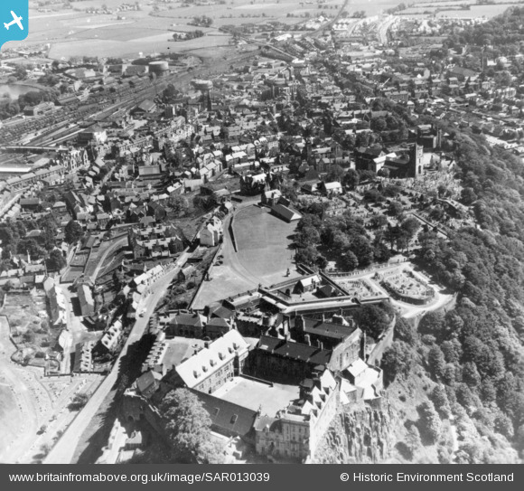
SAR013039 SCOTLAND (1950). Stirling Castle and town Stirling, Stirlingshire, Scotland. An oblique aerial photograph taken facing South/East.
© Copyright OpenStreetMap contributors and licensed by the OpenStreetMap Foundation. 2026. Cartography is licensed as CC BY-SA.
Nearby Images (9)
SAR008644

SAR013039

SAR018753

SAR018754

SPW020254

SPW040344

SAW024466

SPW020258

SAR013040

Details
| Title | [SAR013039] Stirling Castle and town Stirling, Stirlingshire, Scotland. An oblique aerial photograph taken facing South/East. |
| Reference | SAR013039 |
| Date | 1950 |
| Link | NRHE Collection item 1437832 |
| Place name | |
| Parish | STIRLING |
| District | STIRLING |
| Country | SCOTLAND |
| Easting / Northing | 279000, 694000 |
| Longitude / Latitude | -3.9466416117486, 56.123438667389 |
| National Grid Reference | NS790940 |
Pins

gBr |
Friday 27th of November 2015 08:48:31 PM | |
|
gBr |
Friday 27th of November 2015 08:41:36 PM | |
|
gBr |
Friday 27th of November 2015 08:40:49 PM |