
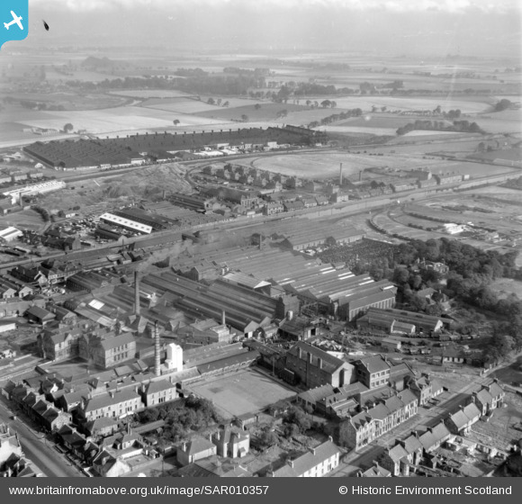
SAR010357 SCOTLAND (1948). General View Falkirk, Stirlingshire, Scotland. An oblique aerial photograph taken facing North.
© Copyright OpenStreetMap contributors and licensed by the OpenStreetMap Foundation. 2025. Cartography is licensed as CC BY-SA.
Nearby Images (2)
SAR010357

SPW020320

Details
| Title | [SAR010357] General View Falkirk, Stirlingshire, Scotland. An oblique aerial photograph taken facing North. |
| Reference | SAR010357 |
| Date | 1948 |
| Link | NRHE Collection item 1437801 |
| Place name | |
| Parish | FALKIRK |
| District | FALKIRK |
| Country | SCOTLAND |
| Easting / Northing | 288850, 681190 |
| Longitude / Latitude | -3.782946107396, 56.01078310191 |
| National Grid Reference | NS889812 |
Pins

Eck |
Thursday 12th of January 2017 01:58:07 AM | |
|
Eck |
Thursday 12th of January 2017 01:55:18 AM | |
|
Eck |
Wednesday 11th of January 2017 08:32:21 PM | |
|
Eck |
Wednesday 11th of January 2017 08:28:22 PM | |
|
Eck |
Wednesday 11th of January 2017 08:24:04 PM | |
|
Eck |
Wednesday 11th of January 2017 08:19:13 PM | |
|
Eck |
Wednesday 11th of January 2017 08:11:14 PM | |
|
Eck |
Wednesday 11th of January 2017 08:00:28 PM | |
|
Eck |
Wednesday 11th of January 2017 07:51:31 PM | |
|
Eck |
Wednesday 11th of January 2017 07:48:41 PM | |
|
Speed |
Thursday 11th of September 2014 11:30:43 PM | |
|
Speed |
Thursday 11th of September 2014 11:05:52 PM | |
|
Speed |
Thursday 11th of September 2014 11:05:22 PM | |
|
Speed |
Thursday 11th of September 2014 11:04:40 PM | |
|
Speed |
Thursday 11th of September 2014 11:04:06 PM |