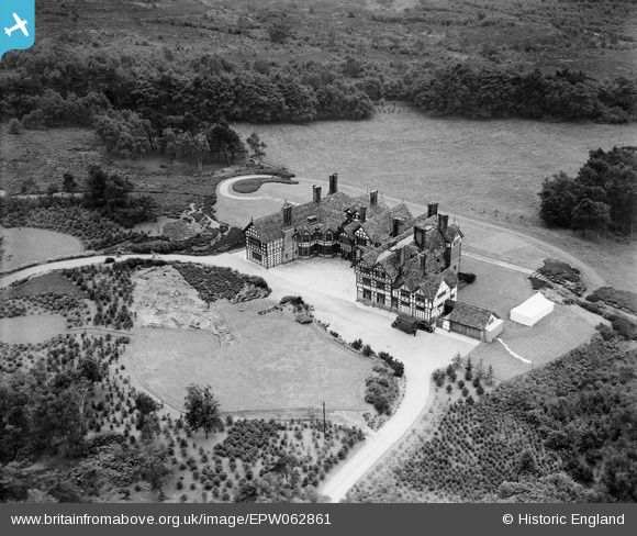
EPW062861 ENGLAND (1939). Hill Bark, Frankby, 1939

© Copyright OpenStreetMap contributors and licensed by the OpenStreetMap Foundation. 2024. Cartography is licensed as CC BY-SA.

Nearby Images (6)

EPW062861
  0° 0m
EPW062860
  243° 2m
EPW062863
  296° 17m
EPW062862
  334° 21m
EPW062864
  304° 23m
EPW062859
  64° 27m

Details

Title [EPW062861] Hill Bark, Frankby, 1939
Reference EPW062861
Date 31-August-1939
Link
Place name FRANKBY
Parish
District
Country ENGLAND
Easting / Northing 324385, 385751
Longitude / Latitude -3.1364086006835, 53.362950072842
National Grid Reference SJ244858

Pins

Hill Bark, Hoylake, Wirral South of the hamlet of Frankby Grade 2* House, Originally built 1891 as Bidston Court at Bidston but in 1921 the house was sold to Sir Ernest Royden, and he arranged for the house to be dismantled and re-erected at the present site in 1929-31 by Rees and Holt. English Heritage Building ID: 443648 Post Code CH48 1NP Timber frame on stone base with brick and stone stacks and stone slate roof. U-plan with service wing to north In 2001 the house was being used as an old people's home, and later in the 2000s it was converted into a hotel There are photographs of the property (on its original site) taken in 1894 on http://www.englishheritagearchives.org.uk/

totoro
Thursday 19th of December 2013 09:03:19 PM