
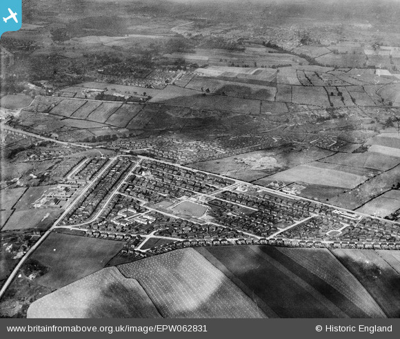
EPW062831 ENGLAND (1939). Frecheville, Sheffield, from the south-west, 1939
© Copyright OpenStreetMap contributors and licensed by the OpenStreetMap Foundation. 2026. Cartography is licensed as CC BY-SA.
Nearby Images (4)
EPW062831

EPW062833

EPW062832

EPW062834

Details
| Title | [EPW062831] Frecheville, Sheffield, from the south-west, 1939 |
| Reference | EPW062831 |
| Date | 30-August-1939 |
| Link | |
| Place name | SHEFFIELD |
| Parish | |
| District | |
| Country | ENGLAND |
| Easting / Northing | 439751, 383390 |
| Longitude / Latitude | -1.4028371978302, 53.345641057259 |
| National Grid Reference | SK398834 |
Pins

Bobby |
Tuesday 27th of July 2021 11:16:35 PM | |
|
Bobby |
Tuesday 27th of July 2021 11:15:28 PM | |
|
Trochilus |
Saturday 22nd of August 2015 11:32:53 AM | |
|
Trochilus |
Saturday 22nd of August 2015 11:30:28 AM | |
|
Trochilus |
Saturday 22nd of August 2015 11:29:26 AM | |
|
Trochilus |
Saturday 22nd of August 2015 11:28:33 AM |