
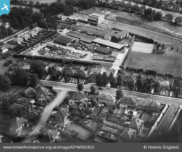
EPW062812 ENGLAND (1939). John Laing and Co Ltd Yard on Bunn's Lane, Mill Hill, 1939
© Copyright OpenStreetMap contributors and licensed by the OpenStreetMap Foundation. 2026. Cartography is licensed as CC BY-SA.
Nearby Images (21)
EPW062812

EPW062814

EPW062809

EPW062811

EPW032948

EPW032947

EPW062808

EPW032950

EPW032955

EPW062819

EPW032958

EPW032956

EPW010851

EPW062817

EPW062810

EPW062815

EPW032949

EPW032954

EPW032953

EPW032952

EPW062818

Details
| Title | [EPW062812] John Laing and Co Ltd Yard on Bunn's Lane, Mill Hill, 1939 |
| Reference | EPW062812 |
| Date | 30-August-1939 |
| Link | |
| Place name | MILL HILL |
| Parish | |
| District | |
| Country | ENGLAND |
| Easting / Northing | 522310, 191333 |
| Longitude / Latitude | -0.23355695021434, 51.607059678635 |
| National Grid Reference | TQ223913 |
Pins
Be the first to add a comment to this image!