
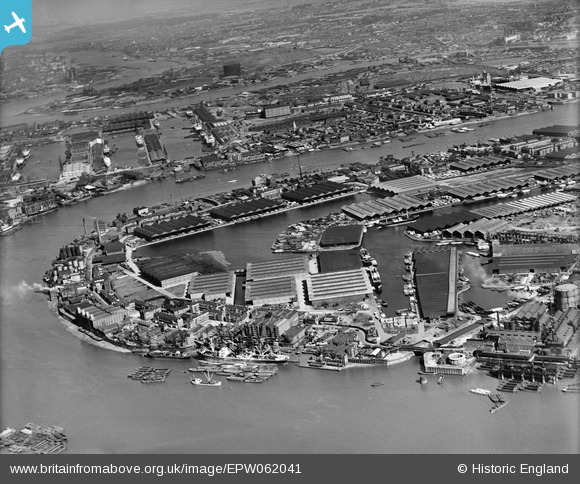
EPW062041 ENGLAND (1939). Surrey Commercial Docks, Rotherhithe, 1939
© Copyright OpenStreetMap contributors and licensed by the OpenStreetMap Foundation. 2026. Cartography is licensed as CC BY-SA.
Nearby Images (4)
EPW062041

EPW059933

EPW009100

EAW043643

Details
| Title | [EPW062041] Surrey Commercial Docks, Rotherhithe, 1939 |
| Reference | EPW062041 |
| Date | 27-June-1939 |
| Link | |
| Place name | ROTHERHITHE |
| Parish | |
| District | |
| Country | ENGLAND |
| Easting / Northing | 536253, 180124 |
| Longitude / Latitude | -0.036651930085583, 51.503121333769 |
| National Grid Reference | TQ363801 |
Pins

@JohnSouthsea |
Tuesday 12th of April 2022 05:52:30 PM | |
|
billybuttons |
Friday 23rd of August 2013 07:43:37 PM | |
|
billybuttons |
Friday 23rd of August 2013 07:39:32 PM | |
|
billybuttons |
Friday 23rd of August 2013 07:38:08 PM | |
|
Chelsea61 |
Friday 23rd of August 2013 01:31:55 AM |
User Comment Contributions
Surrey House and the Half moon and bull's head pub |
billybuttons |
Friday 23rd of August 2013 10:42:00 PM |