
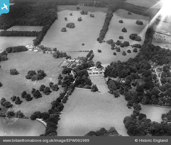
EPW061989 ENGLAND (1939). Hampden House, Great Hampden, from the south-east, 1939. This image has been affected by flare.
© Copyright OpenStreetMap contributors and licensed by the OpenStreetMap Foundation. 2025. Cartography is licensed as CC BY-SA.
Nearby Images (7)
EPW061989

EPW061982

EPW061988

EPW061986

EPW061983

EPW061985

EPW061984

Details
| Title | [EPW061989] Hampden House, Great Hampden, from the south-east, 1939. This image has been affected by flare. |
| Reference | EPW061989 |
| Date | 26-June-1939 |
| Link | |
| Place name | GREAT HAMPDEN |
| Parish | GREAT AND LITTLE HAMPDEN |
| District | |
| Country | ENGLAND |
| Easting / Northing | 485022, 202362 |
| Longitude / Latitude | -0.76923672828205, 51.713079624537 |
| National Grid Reference | SP850024 |
Pins
User Comment Contributions
Grade 1 listed building, entry no 1311378 |

totoro |
Thursday 12th of September 2013 10:29:57 PM |