
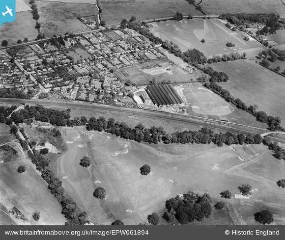
EPW061894 ENGLAND (1939). The Electrical Apparatus Co Ltd Works, the Verulam Golf Course and the surrounding residential area, St Albans, 1939
© Copyright OpenStreetMap contributors and licensed by the OpenStreetMap Foundation. 2026. Cartography is licensed as CC BY-SA.
Nearby Images (19)
EPW061894

EPW061892

EPW060980

EPW061897

EPW061900

EPW061896

EPW061901

EPW061895

EPW061893

EPW060976

EPW061890

EPW061899

EPW061898

EPW060974

EAW027916

EAW027915

EPW061891

EPW061889

EPW061888

Details
| Title | [EPW061894] The Electrical Apparatus Co Ltd Works, the Verulam Golf Course and the surrounding residential area, St Albans, 1939 |
| Reference | EPW061894 |
| Date | June-1939 |
| Link | |
| Place name | ST ALBANS |
| Parish | |
| District | |
| Country | ENGLAND |
| Easting / Northing | 516170, 205457 |
| Longitude / Latitude | -0.31749261114585, 51.735311966395 |
| National Grid Reference | TL162055 |
Pins

John W |
Saturday 8th of February 2020 05:32:45 PM | |
|
John W |
Saturday 8th of February 2020 05:31:24 PM | |
|
John W |
Saturday 8th of February 2020 05:29:56 PM | |
|
John W |
Saturday 8th of February 2020 05:28:59 PM | |
|
John W |
Saturday 8th of February 2020 05:25:47 PM | |
|
John W |
Saturday 8th of February 2020 05:25:17 PM |