
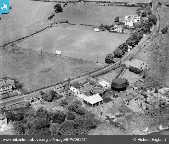
EPW061724 ENGLAND (1939). The Gas Works, Burford, 1939
© Copyright OpenStreetMap contributors and licensed by the OpenStreetMap Foundation. 2026. Cartography is licensed as CC BY-SA.
Nearby Images (13)
EPW061724

EPW061723

EPW061726

EPW061727

EPW061725

EAW029810

EAW029812

EAW029811

EAW029805

EPW061939

EAW029813

EAW029807

EAW029808

Details
| Title | [EPW061724] The Gas Works, Burford, 1939 |
| Reference | EPW061724 |
| Date | 10-June-1939 |
| Link | |
| Place name | BURFORD |
| Parish | BURFORD |
| District | |
| Country | ENGLAND |
| Easting / Northing | 359739, 268646 |
| Longitude / Latitude | -2.5906642788382, 52.31405544583 |
| National Grid Reference | SO597686 |
Pins
User Comment Contributions
EPW061723 to EPW061727 are a group of the Tenbury Wells gas works. All were taken on 10th June 1939 on a beautiful summer's day. Who would have guessed that within three months the country would be entering into another bloody war only a generation after the war to end all wars. |

Class31 |
Tuesday 3rd of September 2013 04:58:50 PM |
Thanks for these ones Class31. They'll be interesting to catalogue, what with the site falling to the north of the local admin boundary...nevertheless, we'll update the details and post your new data here in due course. Yours, Katy Britain from Above Cataloguing Team Leader |
Katy Whitaker |
Tuesday 3rd of September 2013 04:58:50 PM |