
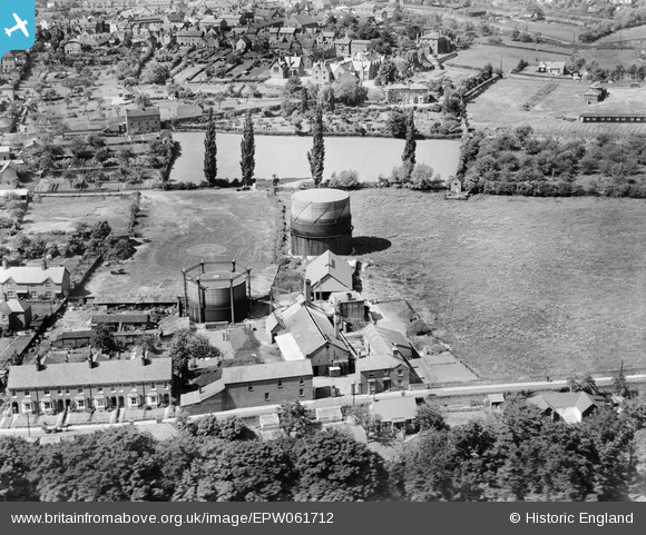
EPW061712 ENGLAND (1939). The Gas Works, Ludlow, 1939
© Copyright OpenStreetMap contributors and licensed by the OpenStreetMap Foundation. 2026. Cartography is licensed as CC BY-SA.
Nearby Images (6)
EPW061712

EPW061929

EPW061709

EPW061711

EPW061710

EPW061923

Details
| Title | [EPW061712] The Gas Works, Ludlow, 1939 |
| Reference | EPW061712 |
| Date | 10-June-1939 |
| Link | |
| Place name | LUDLOW |
| Parish | LUDLOW |
| District | |
| Country | ENGLAND |
| Easting / Northing | 351575, 274358 |
| Longitude / Latitude | -2.7112516736708, 52.364749799509 |
| National Grid Reference | SO516744 |
Pins
Be the first to add a comment to this image!