
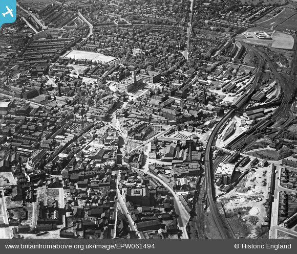
EPW061494 ENGLAND (1939). The town centre, Barnsley, from the south-east, 1939
© Copyright OpenStreetMap contributors and licensed by the OpenStreetMap Foundation. 2026. Cartography is licensed as CC BY-SA.
Nearby Images (7)
EPW061494

EPW055896

EPW021098

EPW057292

EPW021095A

EPW057291

EAW024172

Details
| Title | [EPW061494] The town centre, Barnsley, from the south-east, 1939 |
| Reference | EPW061494 |
| Date | 2-June-1939 |
| Link | |
| Place name | BARNSLEY |
| Parish | |
| District | |
| Country | ENGLAND |
| Easting / Northing | 434699, 406236 |
| Longitude / Latitude | -1.4762071598767, 53.551363126334 |
| National Grid Reference | SE347062 |
Pins
Be the first to add a comment to this image!