
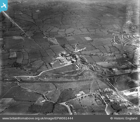
EPW061444 ENGLAND (1939). Chatterley Whitfield Colliery, Whitfield, from the west, 1939. This image has been produced from a damaged negative.
© Copyright OpenStreetMap contributors and licensed by the OpenStreetMap Foundation. 2026. Cartography is licensed as CC BY-SA.
Nearby Images (2)
EPW061444

EPW061446

Details
| Title | [EPW061444] Chatterley Whitfield Colliery, Whitfield, from the west, 1939. This image has been produced from a damaged negative. |
| Reference | EPW061444 |
| Date | 1-June-1939 |
| Link | |
| Place name | WHITFIELD |
| Parish | |
| District | |
| Country | ENGLAND |
| Easting / Northing | 387922, 353213 |
| Longitude / Latitude | -2.1803051621819, 53.075710341232 |
| National Grid Reference | SJ879532 |
Pins

IvanSherratt |
Sunday 29th of September 2013 11:34:07 AM | |
|
IvanSherratt |
Sunday 29th of September 2013 11:28:08 AM | |
|
IvanSherratt |
Sunday 29th of September 2013 11:19:15 AM | |
|
IvanSherratt |
Sunday 29th of September 2013 11:13:52 AM | |
|
IvanSherratt |
Sunday 29th of September 2013 11:12:09 AM |