
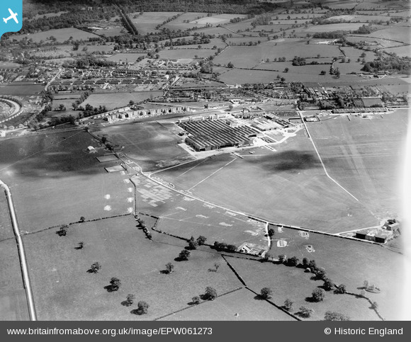
EPW061273 ENGLAND (1939). The Hatfield Aerodrome and Aircraft Factory painted in camouflage, Hatfield, 1939
© Copyright OpenStreetMap contributors and licensed by the OpenStreetMap Foundation. 2026. Cartography is licensed as CC BY-SA.
Nearby Images (3)
EPW061273

EPW047564

EPW046581

Details
| Title | [EPW061273] The Hatfield Aerodrome and Aircraft Factory painted in camouflage, Hatfield, 1939 |
| Reference | EPW061273 |
| Date | 31-May-1939 |
| Link | |
| Place name | HATFIELD |
| Parish | HATFIELD |
| District | |
| Country | ENGLAND |
| Easting / Northing | 521466, 209182 |
| Longitude / Latitude | -0.23952646106738, 51.767668966318 |
| National Grid Reference | TL215092 |
Pins

Matt Aldred edob.mattaldred.com |
Monday 11th of March 2024 05:34:54 PM | |
|
Matt Aldred edob.mattaldred.com |
Monday 11th of March 2024 05:34:36 PM | |
|
Matt Aldred edob.mattaldred.com |
Monday 11th of March 2024 05:33:41 PM | |

CityGardener |
Monday 4th of December 2023 01:18:11 PM | |
|
redmist |
Sunday 13th of March 2022 11:11:54 PM | |
|
redmist |
Tuesday 15th of September 2020 09:50:45 PM | |

Sparky |
Wednesday 26th of July 2017 12:10:42 PM | |
|
ken |
Wednesday 12th of August 2015 02:43:37 PM |