
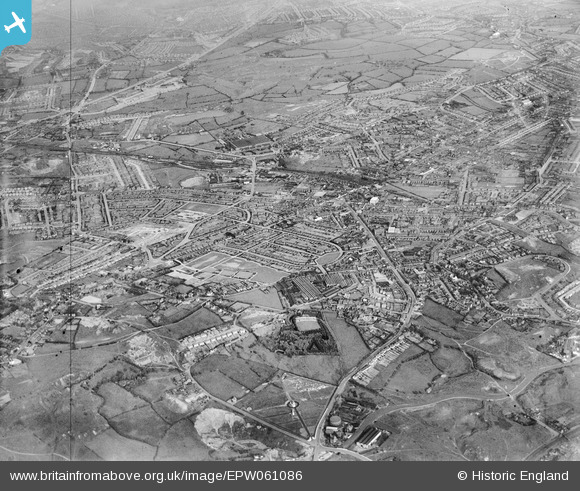
EPW061086 ENGLAND (1939). The town, Blackheath, from the north-west, 1939
© Copyright OpenStreetMap contributors and licensed by the OpenStreetMap Foundation. 2026. Cartography is licensed as CC BY-SA.
Nearby Images (9)
EPW061086

EPW061085

EPW061087

EPW061082

EPW061080

EPW061078

EPW061081

EPW061079

EPW061077

Details
| Title | [EPW061086] The town, Blackheath, from the north-west, 1939 |
| Reference | EPW061086 |
| Date | May-1939 |
| Link | |
| Place name | BLACKHEATH |
| Parish | |
| District | |
| Country | ENGLAND |
| Easting / Northing | 396727, 286805 |
| Longitude / Latitude | -2.0481967141869, 52.478792292615 |
| National Grid Reference | SO967868 |
Pins
Be the first to add a comment to this image!