
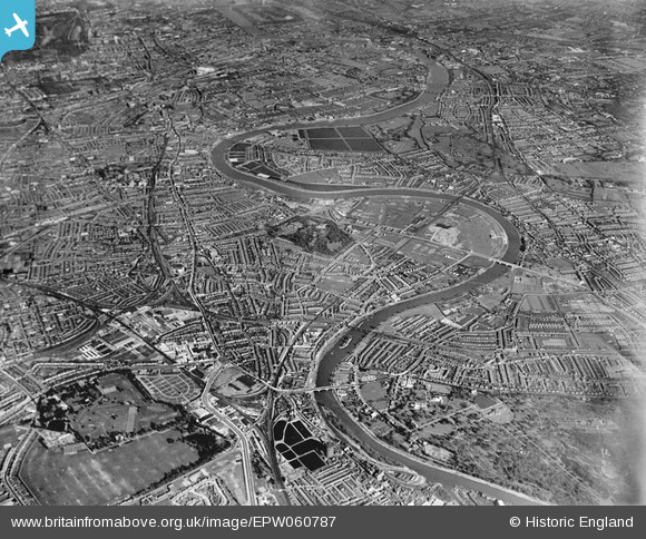
EPW060787 ENGLAND (1939). The River Thames and environs from Kew to Fulham, Chiswick, from the west, 1939
© Copyright OpenStreetMap contributors and licensed by the OpenStreetMap Foundation. 2026. Cartography is licensed as CC BY-SA.
Nearby Images (3)
EPW060787

EPW057070

EPW060786

Details
| Title | [EPW060787] The River Thames and environs from Kew to Fulham, Chiswick, from the west, 1939 |
| Reference | EPW060787 |
| Date | 12-April-1939 |
| Link | |
| Place name | CHISWICK |
| Parish | |
| District | |
| Country | ENGLAND |
| Easting / Northing | 520036, 177651 |
| Longitude / Latitude | -0.27105115382016, 51.484570835546 |
| National Grid Reference | TQ200777 |
Pins

Des Elmes |
Wednesday 14th of December 2022 02:50:16 AM | |
|
Des Elmes |
Wednesday 14th of December 2022 02:48:40 AM | |
|
Des Elmes |
Monday 11th of April 2016 12:00:57 AM | |

Ray Ban |
Saturday 21st of March 2015 12:34:54 PM | |
|
Ray Ban |
Saturday 21st of March 2015 12:34:02 PM | |

Class31 |
Thursday 11th of September 2014 03:21:32 PM | |
|
Class31 |
Thursday 11th of September 2014 03:20:29 PM |

