
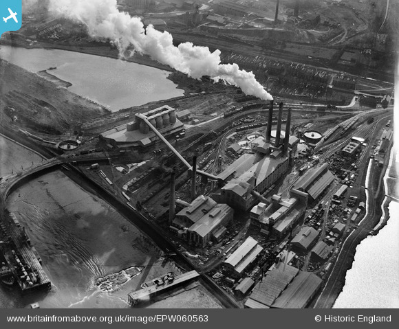
EPW060563 ENGLAND (1939). The Kent Portland Cement Works, Stone, 1939
© Copyright OpenStreetMap contributors and licensed by the OpenStreetMap Foundation. 2026. Cartography is licensed as CC BY-SA.
Nearby Images (14)
EPW060563

EPW060960

EPW060565

EPW060566

EPW060561

EPW060564

EPW060571

EPW060570

EPW060568

EPW060567

EPW060562

EPW060569

EPW017653

EPW060602

Details
| Title | [EPW060563] The Kent Portland Cement Works, Stone, 1939 |
| Reference | EPW060563 |
| Date | 27-February-1939 |
| Link | |
| Place name | STONE |
| Parish | STONE |
| District | |
| Country | ENGLAND |
| Easting / Northing | 557763, 175222 |
| Longitude / Latitude | 0.27086429955088, 51.45347938011 |
| National Grid Reference | TQ578752 |
Pins

Dylan Moore |
Saturday 15th of June 2013 10:30:08 AM | |
|
Dylan Moore |
Saturday 15th of June 2013 10:29:40 AM | |
|
Dylan Moore |
Saturday 15th of June 2013 10:29:27 AM | |
|
Dylan Moore |
Saturday 15th of June 2013 10:29:03 AM |