
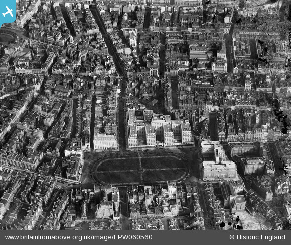
EPW060560 ENGLAND (1939). The new Air Ministry building on Berkeley Square and environs, Mayfair, 1939
© Copyright OpenStreetMap contributors and licensed by the OpenStreetMap Foundation. 2026. Cartography is licensed as CC BY-SA.
Nearby Images (18)
EPW060560

EPW060558

EPW046649

EPW060761

EPW030070

EPW009097

EPW030077

EPW021958

EAW048536

EPW021956

EPW047238

EAW048538

EPW021881

EPW021960

EPW021959

EPW046659

EPW046648

EPW021943

Details
| Title | [EPW060560] The new Air Ministry building on Berkeley Square and environs, Mayfair, 1939 |
| Reference | EPW060560 |
| Date | 28-February-1939 |
| Link | |
| Place name | MAYFAIR |
| Parish | |
| District | |
| Country | ENGLAND |
| Easting / Northing | 528866, 180654 |
| Longitude / Latitude | -0.14283990342797, 51.509617790458 |
| National Grid Reference | TQ289807 |
Pins

HonorMH |
Thursday 5th of September 2024 10:42:33 AM | |
|
HonorMH |
Thursday 5th of September 2024 10:41:29 AM | |
|
HonorMH |
Thursday 5th of September 2024 10:41:23 AM | |

Alan McFaden |
Wednesday 18th of June 2014 04:45:16 PM | |

Class31 |
Wednesday 18th of June 2014 02:31:54 PM | |
|
Class31 |
Wednesday 18th of June 2014 02:23:03 PM | |
|
Class31 |
Wednesday 18th of June 2014 02:20:55 PM | |
|
Class31 |
Wednesday 18th of June 2014 02:18:08 PM | |
|
Class31 |
Wednesday 18th of June 2014 02:17:33 PM | |
|
Class31 |
Wednesday 18th of June 2014 02:17:13 PM | |
|
Class31 |
Wednesday 18th of June 2014 02:16:56 PM | |
|
Alan McFaden |
Monday 1st of July 2013 08:06:02 AM |


