
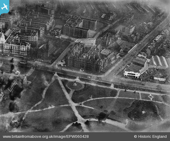
EPW060428 ENGLAND (1939). St Mary's Hospital and Whitworth Park, Manchester, 1939
© Copyright OpenStreetMap contributors and licensed by the OpenStreetMap Foundation. 2026. Cartography is licensed as CC BY-SA.
Nearby Images (16)
EPW060428

EPW060424

EPW060430

EPW060429

EPW060432

EPW060425

EPW060427

EPW060433

EPW060426

EPW060431

EPW016726

EPW060423

EPW017615

EPW016725

EPW019134

EPW055072

Details
| Title | [EPW060428] St Mary's Hospital and Whitworth Park, Manchester, 1939 |
| Reference | EPW060428 |
| Date | 6-February-1939 |
| Link | |
| Place name | MANCHESTER |
| Parish | |
| District | |
| Country | ENGLAND |
| Easting / Northing | 384994, 395896 |
| Longitude / Latitude | -2.2260297209398, 53.459345307527 |
| National Grid Reference | SJ850959 |
Pins
Be the first to add a comment to this image!