
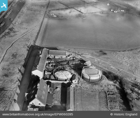
EPW060285 ENGLAND (1938). The town Gas Works off Victoria Street, Hednesford, 1938
© Copyright OpenStreetMap contributors and licensed by the OpenStreetMap Foundation. 2026. Cartography is licensed as CC BY-SA.
Nearby Images (5)
EPW060285

EPW060286

EPW060287

EPW060289

EPW060288

Details
| Title | [EPW060285] The town Gas Works off Victoria Street, Hednesford, 1938 |
| Reference | EPW060285 |
| Date | 26-November-1938 |
| Link | |
| Place name | HEDNESFORD |
| Parish | HEDNESFORD |
| District | |
| Country | ENGLAND |
| Easting / Northing | 400225, 312607 |
| Longitude / Latitude | -1.9966692058273, 52.71078353308 |
| National Grid Reference | SK002126 |
