
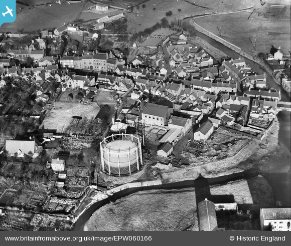
EPW060166 ENGLAND (1938). The Gas Works, Nantwich, 1938
© Copyright OpenStreetMap contributors and licensed by the OpenStreetMap Foundation. 2026. Cartography is licensed as CC BY-SA.
Nearby Images (6)
EPW060166

EPW060167

EPW060164

EPW060165

EPW038475

EPW038472

Details
| Title | [EPW060166] The Gas Works, Nantwich, 1938 |
| Reference | EPW060166 |
| Date | 15-November-1938 |
| Link | |
| Place name | NANTWICH |
| Parish | NANTWICH |
| District | |
| Country | ENGLAND |
| Easting / Northing | 364858, 352345 |
| Longitude / Latitude | -2.5245082578507, 53.066887592331 |
| National Grid Reference | SJ649523 |
Pins

totoro |
Sunday 23rd of June 2013 11:41:25 AM | |
|
totoro |
Sunday 23rd of June 2013 11:41:09 AM | |
|
totoro |
Sunday 23rd of June 2013 11:40:07 AM | |
|
totoro |
Sunday 23rd of June 2013 11:39:50 AM | |
|
totoro |
Sunday 23rd of June 2013 11:38:37 AM | |
|
totoro |
Sunday 23rd of June 2013 11:37:25 AM | |
|
totoro |
Sunday 23rd of June 2013 11:36:04 AM | |
|
totoro |
Sunday 23rd of June 2013 11:34:43 AM | |
|
totoro |
Sunday 23rd of June 2013 11:33:53 AM | |
|
totoro |
Sunday 23rd of June 2013 11:33:05 AM |