
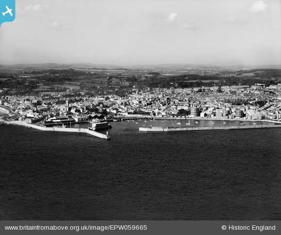
EPW059665 ENGLAND (1938). The harbour and town, Penzance, from the east, 1938
© Copyright OpenStreetMap contributors and licensed by the OpenStreetMap Foundation. 2026. Cartography is licensed as CC BY-SA.
Nearby Images (3)
EPW059665

EAW033634

EPW059666

Details
| Title | [EPW059665] The harbour and town, Penzance, from the east, 1938 |
| Reference | EPW059665 |
| Date | 24-September-1938 |
| Link | |
| Place name | PENZANCE |
| Parish | PENZANCE |
| District | |
| Country | ENGLAND |
| Easting / Northing | 147954, 30236 |
| Longitude / Latitude | -5.5262670788172, 50.117969329716 |
| National Grid Reference | SW480302 |
Pins

dave43 |
Saturday 21st of July 2018 08:08:54 PM |
User Comment Contributions

St. Mary's Church, Penzance, 15/04/2015 |

Class31 |
Wednesday 29th of April 2015 12:07:35 PM |