
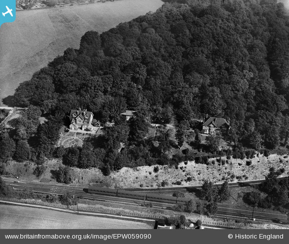
EPW059090 ENGLAND (1938). Croxley Wood House and Woodleys House, Croxley Green, 1938
© Copyright OpenStreetMap contributors and licensed by the OpenStreetMap Foundation. 2026. Cartography is licensed as CC BY-SA.
Nearby Images (2)
EPW059090

EPW059091

Details
| Title | [EPW059090] Croxley Wood House and Woodleys House, Croxley Green, 1938 |
| Reference | EPW059090 |
| Date | 2-September-1938 |
| Link | |
| Place name | CROXLEY GREEN |
| Parish | CROXLEY GREEN |
| District | |
| Country | ENGLAND |
| Easting / Northing | 506968, 194727 |
| Longitude / Latitude | -0.45400162405655, 51.640692780245 |
| National Grid Reference | TQ070947 |
Pins

The Laird |
Thursday 5th of October 2017 07:50:03 PM | |
|
Croxley history |
Wednesday 12th of June 2013 09:58:03 PM |