
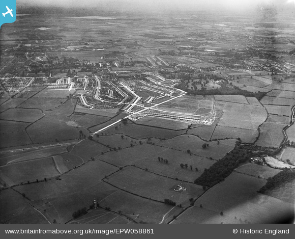
EPW058861 ENGLAND (1938). New residential area under construction off Kingshill Avenue and the surrounding countryside, Hayes, 1938
© Copyright OpenStreetMap contributors and licensed by the OpenStreetMap Foundation. 2026. Cartography is licensed as CC BY-SA.
Nearby Images (3)
EPW058861

EPW058859

EPW058858

Details
| Title | [EPW058861] New residential area under construction off Kingshill Avenue and the surrounding countryside, Hayes, 1938 |
| Reference | EPW058861 |
| Date | 24-August-1938 |
| Link | |
| Place name | HAYES |
| Parish | |
| District | |
| Country | ENGLAND |
| Easting / Northing | 509821, 182738 |
| Longitude / Latitude | -0.41653589245223, 51.532374532202 |
| National Grid Reference | TQ098827 |
