
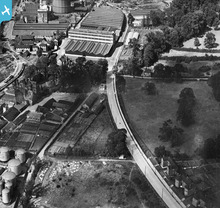
EPW058773 ENGLAND (1938). Landseer Road, Holywells Road and environs, Ipswich, 1938

© Copyright OpenStreetMap contributors and licensed by the OpenStreetMap Foundation. 2026. Cartography is licensed as CC BY-SA.
Nearby Images (9)
EPW058773

EPW058771

EAW033330

EPW058770

EPW058772

EPW032850

EPW032835

EPW001825

EAW025121

Details
| Title | [EPW058773] Landseer Road, Holywells Road and environs, Ipswich, 1938 |
| Reference | EPW058773 |
| Date | 23-August-1938 |
| Link | |
| Place name | IPSWICH |
| Parish | |
| District | |
| Country | ENGLAND |
| Easting / Northing | 617185, 243137 |
| Longitude / Latitude | 1.1674040518602, 52.043589718423 |
| National Grid Reference | TM172431 |
Pins

Where's Canning Town? |
Saturday 31st of October 2015 09:11:24 PM |
User Comment Contributions
Tolly Cobbold's Cliff Quay brewery. Now derelict. |
Where's Canning Town? |
Saturday 31st of October 2015 09:10:33 PM |