
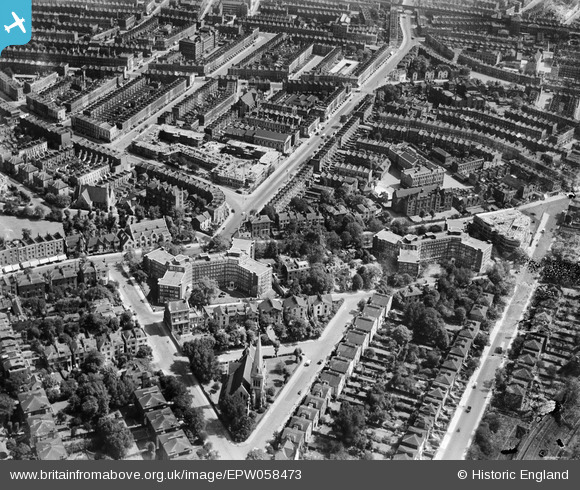
EPW058473 ENGLAND (1938). Eton Rise, Eton Place, Prince of Wales Road and environs, Maitland Park, 1938
© Copyright OpenStreetMap contributors and licensed by the OpenStreetMap Foundation. 2026. Cartography is licensed as CC BY-SA.
Nearby Images (31)
EPW058473

EPW058474

EPW058476

EPW060302
, Maitland Park, 1938")
EPW060332

EPW058477

EPW060303
, Maitland Park, 1938")
EPW058475

EPW060306
, Maitland Park, 1938")
EPW060304
, Maitland Park, 1938")
EPW060331

EPW058478

EPW060305
, Maitland Park, 1938")
EPW058594

EPW058593

EPW058591

EPW060333

EPW058592

EPW060330

EPW060335

EPW060334

EPW056360

EPW056362

EPW056361

EPW058590

EPW056358

EPW056363

EPW056364

EPW056365

EPW056359

EPW000808

Details
| Title | [EPW058473] Eton Rise, Eton Place, Prince of Wales Road and environs, Maitland Park, 1938 |
| Reference | EPW058473 |
| Date | 2-August-1938 |
| Link | |
| Place name | MAITLAND PARK |
| Parish | |
| District | |
| Country | ENGLAND |
| Easting / Northing | 528014, 184558 |
| Longitude / Latitude | -0.15369255579583, 51.544899847158 |
| National Grid Reference | TQ280846 |
Pins

Robin |
Thursday 30th of September 2021 07:26:13 PM | |

Class31 |
Tuesday 15th of October 2013 08:19:50 PM | |
|
Class31 |
Tuesday 15th of October 2013 08:19:32 PM | |
|
Class31 |
Tuesday 15th of October 2013 08:19:09 PM | |
|
Class31 |
Tuesday 15th of October 2013 08:18:47 PM | |
|
Class31 |
Tuesday 15th of October 2013 08:53:13 AM | |
|
Class31 |
Tuesday 15th of October 2013 08:44:09 AM | |
|
Class31 |
Tuesday 15th of October 2013 08:43:43 AM |