
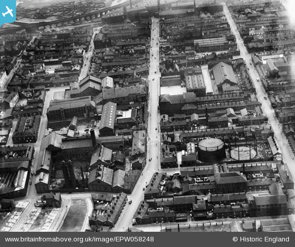
EPW058248 ENGLAND (1938). Oldham Road and environs, Ashton-under-Lyne, 1938
© Copyright OpenStreetMap contributors and licensed by the OpenStreetMap Foundation. 2026. Cartography is licensed as CC BY-SA.
Nearby Images (2)
EPW058248

EPW058249

Details
| Title | [EPW058248] Oldham Road and environs, Ashton-under-Lyne, 1938 |
| Reference | EPW058248 |
| Date | 25-July-1938 |
| Link | |
| Place name | ASHTON-UNDER-LYNE |
| Parish | |
| District | |
| Country | ENGLAND |
| Easting / Northing | 393576, 399101 |
| Longitude / Latitude | -2.0968281880973, 53.48833121779 |
| National Grid Reference | SJ936991 |
Pins

wagstaff |
Wednesday 22nd of April 2026 06:13:52 PM | |
|
wagstaff |
Thursday 26th of March 2026 06:21:25 PM | |
|
mossleymike |
Monday 7th of June 2021 04:33:32 PM | |
|
Robert Eric Lucas |
Tuesday 1st of December 2020 04:23:44 PM | |
|
TheBlueCube |
Sunday 27th of July 2014 11:08:59 PM | |
|
TheBlueCube |
Sunday 27th of July 2014 11:06:48 PM | |
|
TheBlueCube |
Sunday 27th of July 2014 10:39:17 PM | |
|
stardelta |
Tuesday 10th of June 2014 09:13:08 PM |
