
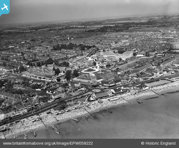
EPW058222 ENGLAND (1938). The Kursaal, Southend-on-Sea, from the south-west, 1938
© Copyright OpenStreetMap contributors and licensed by the OpenStreetMap Foundation. 2026. Cartography is licensed as CC BY-SA.
Nearby Images (48)
EPW058222

EAW002219

EPW058224

EPW036730

EPW037016

EPW058226

EPW036995

EAW053086

EPW000443

EPW024890

EPW000552

EAW024660

EPW058500

EPW000444

EAW002206

EPW016549

EPW062745

EPW036723

EAW002192

EPW054671

EPW010871

EPW037007

EPW040987

EPW036612

EPW032920

EPW036726

EPW024869

EPW037003

EPW032919

EAW024659

EPW036615

EPW036978

EPW062743

EPW039864

EPW036616

EPW036981

EPW036977

EPW032924

EPW032925

EPW036980

EPW039862

EPW032921

EPW058446

EPW036614

EPW058223

EPW058225

EPW036976

EPW058447

Details
| Title | [EPW058222] The Kursaal, Southend-on-Sea, from the south-west, 1938 |
| Reference | EPW058222 |
| Date | 23-July-1938 |
| Link | |
| Place name | SOUTHEND-ON-SEA |
| Parish | |
| District | |
| Country | ENGLAND |
| Easting / Northing | 588964, 185007 |
| Longitude / Latitude | 0.72471488764266, 51.531819046639 |
| National Grid Reference | TQ890850 |
Pins

Triggy |
Friday 28th of February 2014 09:58:08 PM |
User Comment Contributions
Great photo. So many old Southenders want to see the buildings that used to be on the corner opposite the Kursaal. |
Sara |
Friday 28th of February 2014 09:27:32 PM |