
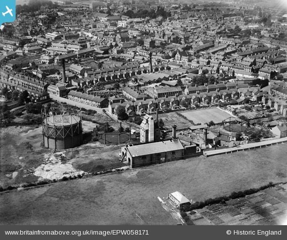
EPW058171 ENGLAND (1938). Melton Mowbray Gas Works and environs, Melton Mowbray, 1938
© Copyright OpenStreetMap contributors and licensed by the OpenStreetMap Foundation. 2026. Cartography is licensed as CC BY-SA.
Nearby Images (7)
EPW058171

EPW058169

EPW058170

EPW058168

EPW058213

EPW058211

EPW014947

Details
| Title | [EPW058171] Melton Mowbray Gas Works and environs, Melton Mowbray, 1938 |
| Reference | EPW058171 |
| Date | 20-July-1938 |
| Link | |
| Place name | MELTON MOWBRAY |
| Parish | |
| District | |
| Country | ENGLAND |
| Easting / Northing | 475766, 319027 |
| Longitude / Latitude | -0.87703064981249, 52.763188458993 |
| National Grid Reference | SK758190 |


