
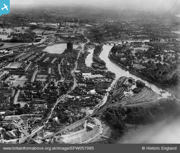
EPW057985 ENGLAND (1938). Brentford Dock, High Street and the River Thames, Brentford, from the south-west, 1938
© Copyright OpenStreetMap contributors and licensed by the OpenStreetMap Foundation. 2026. Cartography is licensed as CC BY-SA.
Nearby Images (3)
EPW057985

EPW055295

EPW060952

Details
| Title | [EPW057985] Brentford Dock, High Street and the River Thames, Brentford, from the south-west, 1938 |
| Reference | EPW057985 |
| Date | 17-July-1938 |
| Link | |
| Place name | BRENTFORD |
| Parish | |
| District | |
| Country | ENGLAND |
| Easting / Northing | 518036, 177480 |
| Longitude / Latitude | -0.29990174456244, 51.483454834745 |
| National Grid Reference | TQ180775 |
Pins

Leslie B |
Tuesday 28th of June 2022 12:14:40 AM | |
|
Leslie B |
Tuesday 28th of June 2022 12:13:34 AM | |

Des Elmes |
Saturday 16th of April 2016 01:48:14 AM | |
|
Des Elmes |
Saturday 16th of April 2016 01:44:04 AM |