
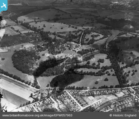
EPW057963 ENGLAND (1938). Osterley House and Park, Osterley, 1938. This image has been produced from a damaged print.
© Copyright OpenStreetMap contributors and licensed by the OpenStreetMap Foundation. 2026. Cartography is licensed as CC BY-SA.
Nearby Images (9)
EPW057963

EPW023236

EPW057962

EPW037579

EPW037578

EPW060615

EPW037580

EPW017386

EPW060618

Details
| Title | [EPW057963] Osterley House and Park, Osterley, 1938. This image has been produced from a damaged print. |
| Reference | EPW057963 |
| Date | 13-July-1938 |
| Link | |
| Place name | OSTERLEY |
| Parish | |
| District | |
| Country | ENGLAND |
| Easting / Northing | 514464, 177929 |
| Longitude / Latitude | -0.35118118061444, 51.4882251709 |
| National Grid Reference | TQ145779 |
Pins
Be the first to add a comment to this image!