
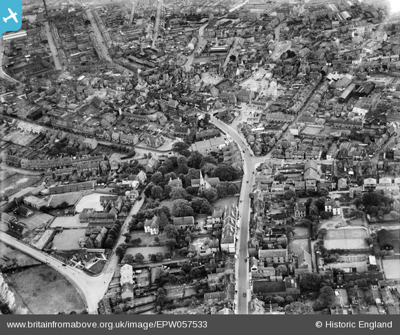
EPW057533 ENGLAND (1938). The High Street and environs, Lye, 1938
© Copyright OpenStreetMap contributors and licensed by the OpenStreetMap Foundation. 2026. Cartography is licensed as CC BY-SA.
Nearby Images (2)
EPW057533

EPW057532

Details
| Title | [EPW057533] The High Street and environs, Lye, 1938 |
| Reference | EPW057533 |
| Date | 9-June-1938 |
| Link | |
| Place name | LYE |
| Parish | |
| District | |
| Country | ENGLAND |
| Easting / Northing | 392429, 284380 |
| Longitude / Latitude | -2.1114319461369, 52.456946385833 |
| National Grid Reference | SO924844 |
Pins

reg instone |
Saturday 21st of February 2015 02:28:07 AM | |
|
reg instone |
Saturday 21st of February 2015 02:26:14 AM | |
|
reg instone |
Saturday 21st of February 2015 02:25:39 AM |
User Comment Contributions
Looking east along High St, towards Cradley |
reg instone |
Saturday 21st of February 2015 02:29:25 AM |