
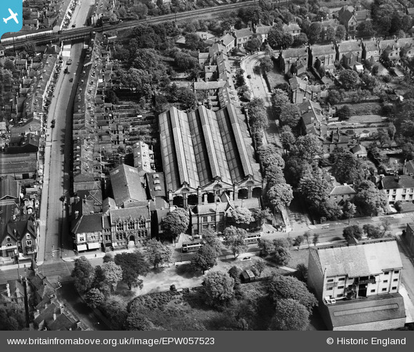
EPW057523 ENGLAND (1938). Moseley Road Tram Depot and environs, Moseley, 1938
© Copyright OpenStreetMap contributors and licensed by the OpenStreetMap Foundation. 2026. Cartography is licensed as CC BY-SA.
Nearby Images (12)
EPW057523

EPW005405

EPW057518

EPW057521

EPW058127

EPW058126

EPW058120

EPW058121

EPW058125

EPW058124

EPW058123

EPW058122

Details
| Title | [EPW057523] Moseley Road Tram Depot and environs, Moseley, 1938 |
| Reference | EPW057523 |
| Date | 10-June-1938 |
| Link | |
| Place name | MOSELEY |
| Parish | |
| District | |
| Country | ENGLAND |
| Easting / Northing | 407837, 284043 |
| Longitude / Latitude | -1.8846609219389, 52.453912656968 |
| National Grid Reference | SP078840 |
Pins

Dylan Moore |
Saturday 22nd of June 2013 10:52:37 AM | |
|
Dylan Moore |
Saturday 22nd of June 2013 10:52:14 AM | |

MB |
Saturday 22nd of June 2013 10:09:24 AM | |
|
MB |
Saturday 22nd of June 2013 10:08:25 AM | |
|
MB |
Saturday 22nd of June 2013 10:07:23 AM | |
This is most likely Brighton Road Station. Moseley Station was much nearer to Moseley Village. |
RFD W'ton |
Thursday 11th of September 2014 11:38:49 PM |
I've just checked the old OS mapping and this is definitely Brighton Road Station. |

Laura Maddison |
Friday 12th of September 2014 09:44:29 AM |
|
MB |
Saturday 22nd of June 2013 10:05:17 AM | |
|
MB |
Saturday 22nd of June 2013 10:04:56 AM | |
|
MB |
Saturday 22nd of June 2013 10:04:41 AM | |
|
MB |
Saturday 22nd of June 2013 10:04:27 AM | |
|
MB |
Saturday 22nd of June 2013 10:04:09 AM |