
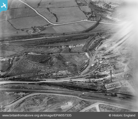
EPW057335 ENGLAND (1938). The Staveley Coal and Iron Company Ltd Works, Staveley, 1938. This image has been affected by flare.
© Copyright OpenStreetMap contributors and licensed by the OpenStreetMap Foundation. 2026. Cartography is licensed as CC BY-SA.
Nearby Images (6)
EPW057335

EPW057342

EAW003057

EPW041671

EPW057352

EAW044348

Details
| Title | [EPW057335] The Staveley Coal and Iron Company Ltd Works, Staveley, 1938. This image has been affected by flare. |
| Reference | EPW057335 |
| Date | 3-June-1938 |
| Link | |
| Place name | STAVELEY |
| Parish | STAVELEY |
| District | |
| Country | ENGLAND |
| Easting / Northing | 441096, 374989 |
| Longitude / Latitude | -1.3837215516835, 53.270019725434 |
| National Grid Reference | SK411750 |
Pins
Be the first to add a comment to this image!