
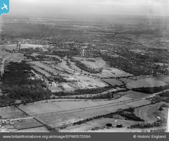
EPW057209A ENGLAND (1938). The Royal Wimbledon Golf Course and environs, Wimbledon, from the west, 1938
© Copyright OpenStreetMap contributors and licensed by the OpenStreetMap Foundation. 2026. Cartography is licensed as CC BY-SA.
Nearby Images (9)
EPW057209A

EPW015718

EPW057209

EPW057210

EPW057212

EPW015716

EPW015713

EPW015719

EPW057208

Details
| Title | [EPW057209A] The Royal Wimbledon Golf Course and environs, Wimbledon, from the west, 1938 |
| Reference | EPW057209A |
| Date | 26-May-1938 |
| Link | |
| Place name | WIMBLEDON |
| Parish | |
| District | |
| Country | ENGLAND |
| Easting / Northing | 521891, 170879 |
| Longitude / Latitude | -0.24667991245478, 51.423304839289 |
| National Grid Reference | TQ219709 |
Pins
Be the first to add a comment to this image!