
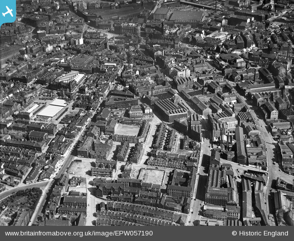
EPW057190 ENGLAND (1938). Westgate, Sunbridge Road and the city centre, Bradford, 1938
© Copyright OpenStreetMap contributors and licensed by the OpenStreetMap Foundation. 2026. Cartography is licensed as CC BY-SA.
Nearby Images (5)
EPW057190

EPW045334

EPW052163

EPW052165

EPW052159

Details
| Title | [EPW057190] Westgate, Sunbridge Road and the city centre, Bradford, 1938 |
| Reference | EPW057190 |
| Date | 24-May-1938 |
| Link | |
| Place name | BRADFORD |
| Parish | |
| District | |
| Country | ENGLAND |
| Easting / Northing | 415930, 433250 |
| Longitude / Latitude | -1.7581401978475, 53.795100392319 |
| National Grid Reference | SE159333 |
Pins

Andrew |
Wednesday 12th of March 2025 09:52:42 AM | |
|
Shipley Flyer |
Sunday 18th of June 2023 09:49:18 AM | |
|
Shipley Flyer |
Sunday 18th of June 2023 09:48:47 AM | |
|
H.J.Hill |
Monday 25th of August 2014 11:45:46 AM | |
|
H.J.Hill |
Monday 25th of August 2014 11:42:48 AM | |
|
H.J.Hill |
Saturday 7th of June 2014 02:13:15 PM | |
|
H.J.Hill |
Saturday 7th of June 2014 02:11:58 PM | |
|
hawkeye |
Saturday 31st of August 2013 06:56:04 AM |