
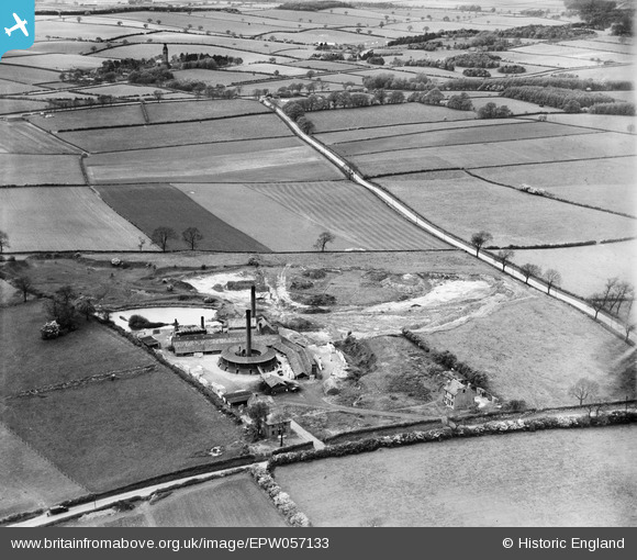
EPW057133 ENGLAND (1938). Ibstock Brick Ltd Brick Works, Dorket Head, 1938
© Copyright OpenStreetMap contributors and licensed by the OpenStreetMap Foundation. 2025. Cartography is licensed as CC BY-SA.
Nearby Images (6)
EPW057133

EPW057135

EPW057134

EPW057138

EPW057137

EPW057136

Details
| Title | [EPW057133] Ibstock Brick Ltd Brick Works, Dorket Head, 1938 |
| Reference | EPW057133 |
| Date | 20-May-1938 |
| Link | |
| Place name | DORKET HEAD |
| Parish | |
| District | |
| Country | ENGLAND |
| Easting / Northing | 459156, 347531 |
| Longitude / Latitude | -1.1179941276286, 53.021494756327 |
| National Grid Reference | SK592475 |
Pins
 pim-54 |
Friday 4th of July 2014 12:17:26 AM | |
pim-54 |
Friday 4th of July 2014 12:15:09 AM | |
pim-54 |
Friday 4th of July 2014 12:11:09 AM | |
pim-54 |
Friday 4th of July 2014 12:09:34 AM | |
pim-54 |
Friday 4th of July 2014 12:07:12 AM |