
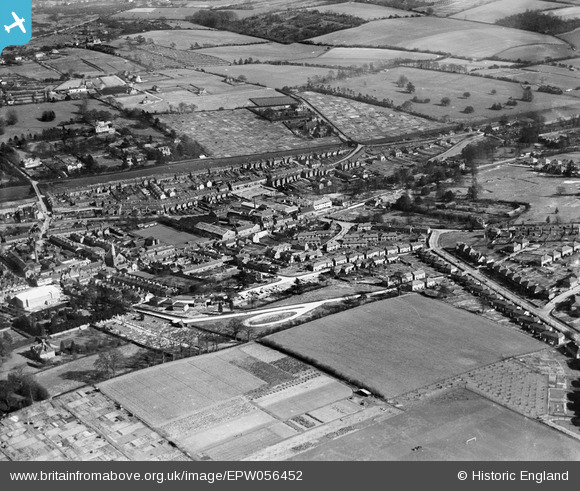
EPW056452 ENGLAND (1938). Curtis Way and environs, Berkhamsted, 1938
© Copyright OpenStreetMap contributors and licensed by the OpenStreetMap Foundation. 2026. Cartography is licensed as CC BY-SA.
Nearby Images (4)
EPW056452

EPW022496

EPW022500

EPW056457

Details
| Title | [EPW056452] Curtis Way and environs, Berkhamsted, 1938 |
| Reference | EPW056452 |
| Date | 4-March-1938 |
| Link | |
| Place name | BERKHAMSTED |
| Parish | BERKHAMSTED |
| District | |
| Country | ENGLAND |
| Easting / Northing | 499732, 207523 |
| Longitude / Latitude | -0.55488568615336, 51.757050474745 |
| National Grid Reference | SP997075 |
