
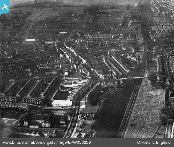
EPW056259 ENGLAND (1938). High Road and environs, Wembley, 1938. This image has been produced from a copy-negative.
© Copyright OpenStreetMap contributors and licensed by the OpenStreetMap Foundation. 2026. Cartography is licensed as CC BY-SA.
Nearby Images (7)
EPW056259

EPW056258

EPW056263

EPW056257

EPW007837

EPW056264

EPW006968

Details
| Title | [EPW056259] High Road and environs, Wembley, 1938. This image has been produced from a copy-negative. |
| Reference | EPW056259 |
| Date | 17-January-1938 |
| Link | |
| Place name | WEMBLEY |
| Parish | |
| District | |
| Country | ENGLAND |
| Easting / Northing | 518359, 185204 |
| Longitude / Latitude | -0.29265709278131, 51.552814408029 |
| National Grid Reference | TQ184852 |
Pins

greenchief |
Tuesday 25th of November 2014 02:06:49 PM | |
|
greenchief |
Tuesday 25th of November 2014 02:05:56 PM | |
|
greenchief |
Tuesday 25th of November 2014 02:03:28 PM |
User Comment Contributions
Viewed from the East looking West |
greenchief |
Tuesday 25th of November 2014 02:05:32 PM |