
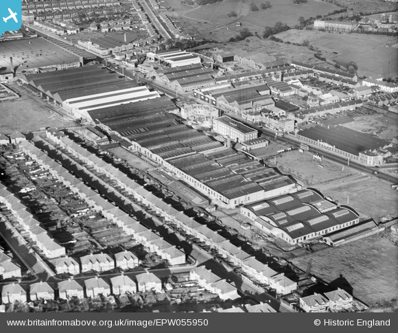
EPW055950 ENGLAND (1937). Works off the Edgware Road including the Phoenix Telephone and Electric Co Works, Kingsbury, 1937
© Copyright OpenStreetMap contributors and licensed by the OpenStreetMap Foundation. 2026. Cartography is licensed as CC BY-SA.
Nearby Images (40)
EPW055950

EPW055944

EPW055943

EPW055947

EPW055952

EPW055949

EPW055951

EPW013752
 on the Hyde (Edgware Road), Kingsbury, 1928. This image has been produced from a print.")
EPW055946

EPW012748

EPW055948

EPW020810

EPW032159

EPW021145

EPW032156

EPW032158

EPW021147

EPW020686

EPW021144

EPW020812

EPW021146

EPW032157

EPW020811

EPW020689

EPW020688

EPW020683

EPW013751

EPW055945

EPR000505

EPW020687

EPW020685

EPW020690

EPW020684

EPW024932

EPW024931

EPW031584

EPW034540

EPW020844

EPW025885

EPW015610

Details
| Title | [EPW055950] Works off the Edgware Road including the Phoenix Telephone and Electric Co Works, Kingsbury, 1937 |
| Reference | EPW055950 |
| Date | 9-November-1937 |
| Link | |
| Place name | KINGSBURY |
| Parish | |
| District | |
| Country | ENGLAND |
| Easting / Northing | 520749, 189475 |
| Longitude / Latitude | -0.25672984646822, 51.590696600116 |
| National Grid Reference | TQ207895 |


