
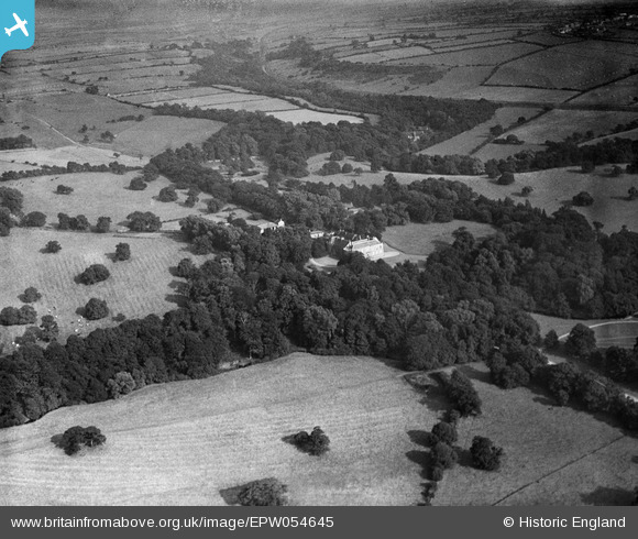
EPW054645 ENGLAND (1937). Croxdale Hall, Sunderland Bridge, from the north-west, 1937
© Copyright OpenStreetMap contributors and licensed by the OpenStreetMap Foundation. 2026. Cartography is licensed as CC BY-SA.
Nearby Images (3)
EPW054645

EPW054644

EPW054641

Details
| Title | [EPW054645] Croxdale Hall, Sunderland Bridge, from the north-west, 1937 |
| Reference | EPW054645 |
| Date | 30-July-1937 |
| Link | |
| Place name | SUNDERLAND BRIDGE |
| Parish | CROXDALE AND HETT |
| District | |
| Country | ENGLAND |
| Easting / Northing | 427207, 537989 |
| Longitude / Latitude | -1.5774088783178, 54.736034791098 |
| National Grid Reference | NZ272380 |
Pins

Chells809 |
Thursday 27th of February 2014 12:06:41 PM | |
|
Chells809 |
Thursday 27th of February 2014 12:05:56 PM | |
|
Chells809 |
Thursday 27th of February 2014 12:04:59 PM | |
|
Chells809 |
Thursday 27th of February 2014 12:04:07 PM |