
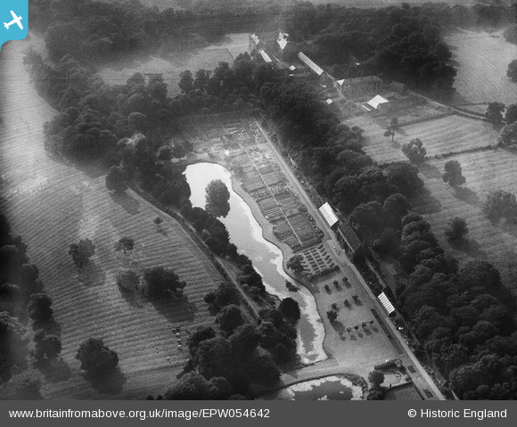
EPW054642 ENGLAND (1937). The fishponds and gardens at Croxdale Hall, Sunderland Bridge, 1937
© Copyright OpenStreetMap contributors and licensed by the OpenStreetMap Foundation. 2026. Cartography is licensed as CC BY-SA.
Nearby Images (5)
EPW054642

EPW054643

EPW054640

EPW054641

EPW054644

Details
| Title | [EPW054642] The fishponds and gardens at Croxdale Hall, Sunderland Bridge, 1937 |
| Reference | EPW054642 |
| Date | 30-July-1937 |
| Link | |
| Place name | SUNDERLAND BRIDGE |
| Parish | CROXDALE AND HETT |
| District | |
| Country | ENGLAND |
| Easting / Northing | 427556, 537772 |
| Longitude / Latitude | -1.5720087803766, 54.734065523036 |
| National Grid Reference | NZ276378 |
Pins
Be the first to add a comment to this image!