
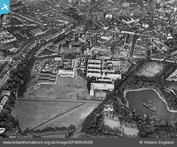
EPW054568 ENGLAND (1937). The Royal Victoria Infirmary and environs, Newcastle upon Tyne, 1937
© Copyright OpenStreetMap contributors and licensed by the OpenStreetMap Foundation. 2026. Cartography is licensed as CC BY-SA.
Nearby Images (5)
EPW054568

EPW054567

EPW014375

EPW019827

EPW054560

Details
| Title | [EPW054568] The Royal Victoria Infirmary and environs, Newcastle upon Tyne, 1937 |
| Reference | EPW054568 |
| Date | 30-July-1937 |
| Link | |
| Place name | NEWCASTLE UPON TYNE |
| Parish | |
| District | |
| Country | ENGLAND |
| Easting / Northing | 424468, 565064 |
| Longitude / Latitude | -1.6176563394143, 54.979504855365 |
| National Grid Reference | NZ245651 |
Pins

Tony Redpath |
Tuesday 19th of December 2017 08:10:26 AM | |
|
Tony Redpath |
Monday 18th of December 2017 10:59:53 AM |