
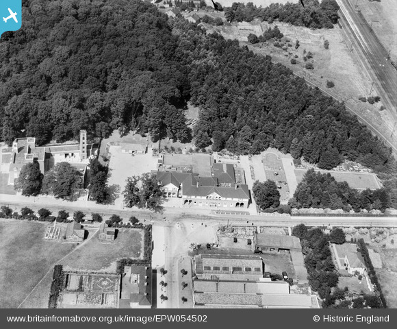
EPW054502 ENGLAND (1937). The Cherry Tree Restaurant, Welwyn Garden City, 1937
© Copyright OpenStreetMap contributors and licensed by the OpenStreetMap Foundation. 2026. Cartography is licensed as CC BY-SA.
Nearby Images (28)
EPW054502

EPW054505

EPW062002

EPW047382

EPW054498

EPW062005

EPW022015

EPW062052

EPW022023

EPW062001

EPW062049

EPW062006

EPW062003

EPW054533

EPW062048

EPW054497

EPW054490

EPW047363

EPW047380

EPW022024

EPW054493

EPW047364

EPW054496

EPW025528

EPW047362

EPW047365

EAW053083

EPW054507

Details
| Title | [EPW054502] The Cherry Tree Restaurant, Welwyn Garden City, 1937 |
| Reference | EPW054502 |
| Date | 30-July-1937 |
| Link | |
| Place name | WELWYN GARDEN CITY |
| Parish | |
| District | |
| Country | ENGLAND |
| Easting / Northing | 523914, 213208 |
| Longitude / Latitude | -0.20262696946729, 51.803316672075 |
| National Grid Reference | TL239132 |
Pins
Be the first to add a comment to this image!