
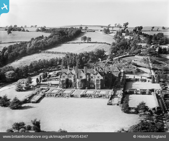
EPW054347 ENGLAND (1937). Tirley Garth, Willington Corner, from the south, 1937
© Copyright OpenStreetMap contributors and licensed by the OpenStreetMap Foundation. 2026. Cartography is licensed as CC BY-SA.
Nearby Images (8)
EPW054347

EPW054350

EPW054351

EPW054348

EPW054349

EPW054346

EPW054353

EPW054352

Details
| Title | [EPW054347] Tirley Garth, Willington Corner, from the south, 1937 |
| Reference | EPW054347 |
| Date | 20-July-1937 |
| Link | |
| Place name | WILLINGTON CORNER |
| Parish | WILLINGTON |
| District | |
| Country | ENGLAND |
| Easting / Northing | 354526, 366208 |
| Longitude / Latitude | -2.6806733080861, 53.19072792428 |
| National Grid Reference | SJ545662 |
Pins
Be the first to add a comment to this image!