
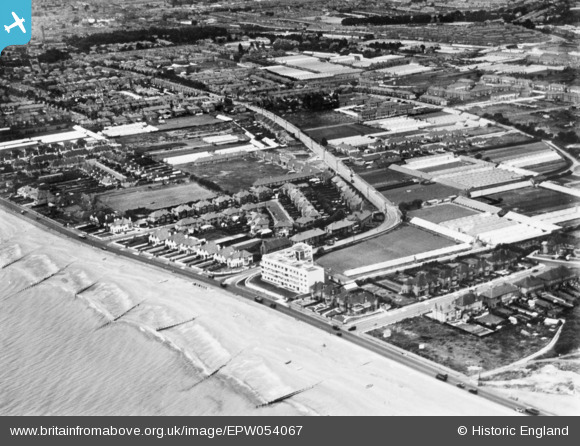
EPW054067 ENGLAND (1937). Brougham Road and environs, Worthing, 1937. This image has been produced from a copy-negative.
© Copyright OpenStreetMap contributors and licensed by the OpenStreetMap Foundation. 2026. Cartography is licensed as CC BY-SA.
Nearby Images (2)
EPW054067

EPW042994

Details
| Title | [EPW054067] Brougham Road and environs, Worthing, 1937. This image has been produced from a copy-negative. |
| Reference | EPW054067 |
| Date | June-1937 |
| Link | |
| Place name | WORTHING |
| Parish | |
| District | |
| Country | ENGLAND |
| Easting / Northing | 516778, 103155 |
| Longitude / Latitude | -0.34213192076118, 50.81559202179 |
| National Grid Reference | TQ168032 |
Pins

SophieWattsit |
Tuesday 9th of February 2021 11:45:50 PM | |
|
SophieWattsit |
Tuesday 9th of February 2021 11:44:34 PM | |
|
SophieWattsit |
Tuesday 9th of February 2021 11:40:12 PM | |

SAS |
Tuesday 29th of November 2016 02:40:16 AM | |
|
SAS |
Tuesday 29th of November 2016 02:38:15 AM | |
|
SAS |
Tuesday 29th of November 2016 02:36:14 AM | |
|
SAS |
Tuesday 29th of November 2016 02:30:39 AM |