
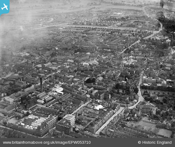
EPW053710 ENGLAND (1937). The town, Kettering, 1937
© Copyright OpenStreetMap contributors and licensed by the OpenStreetMap Foundation. 2026. Cartography is licensed as CC BY-SA.
Nearby Images (2)
EPW053710

EPW053709

Details
| Title | [EPW053710] The town, Kettering, 1937 |
| Reference | EPW053710 |
| Date | June-1937 |
| Link | |
| Place name | KETTERING |
| Parish | |
| District | |
| Country | ENGLAND |
| Easting / Northing | 486727, 278875 |
| Longitude / Latitude | -0.72512871028293, 52.400629108072 |
| National Grid Reference | SP867789 |
Pins

EastMarple1 |
Wednesday 6th of November 2013 09:33:00 AM | |
|
EastMarple1 |
Wednesday 6th of November 2013 09:29:52 AM | |
|
EastMarple1 |
Wednesday 6th of November 2013 09:26:21 AM | |
|
EastMarple1 |
Wednesday 6th of November 2013 09:21:21 AM |