
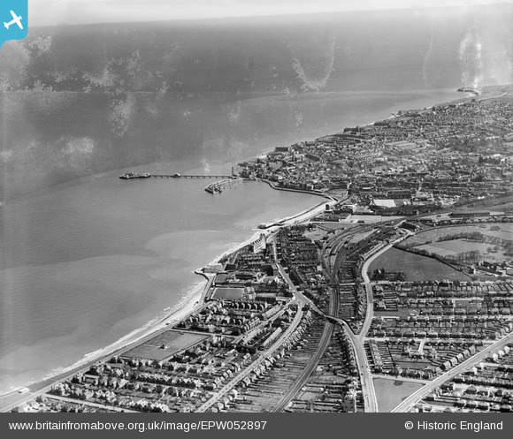
EPW052897 ENGLAND (1937). Margate Railway Station, the harbour and environs, Westbrook, from the south-west, 1937
© Copyright OpenStreetMap contributors and licensed by the OpenStreetMap Foundation. 2026. Cartography is licensed as CC BY-SA.
Nearby Images (3)
EPW052897

EPW018606

EAW024854

Details
| Title | [EPW052897] Margate Railway Station, the harbour and environs, Westbrook, from the south-west, 1937 |
| Reference | EPW052897 |
| Date | 24-April-1937 |
| Link | |
| Place name | WESTBROOK |
| Parish | |
| District | |
| Country | ENGLAND |
| Easting / Northing | 634412, 170524 |
| Longitude / Latitude | 1.3693383847888, 51.384771473264 |
| National Grid Reference | TR344705 |
Pins

Mark Godden |
Sunday 20th of April 2025 10:59:50 AM | |
|
Bryn |
Sunday 19th of July 2015 07:47:45 PM | |
|
Bryn |
Sunday 19th of July 2015 07:46:32 PM | |
|
Triggy |
Thursday 23rd of January 2014 09:43:09 PM |
User Comment Contributions
Margate West station; the 'West' was dropped after the East station closed in 1953. |
John W |
Friday 7th of October 2016 08:27:33 PM |