
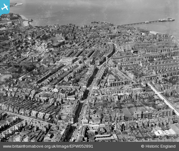
EPW052891 ENGLAND (1937). Northdown Road and environs, Cliftonville, 1937
© Copyright OpenStreetMap contributors and licensed by the OpenStreetMap Foundation. 2026. Cartography is licensed as CC BY-SA.
Nearby Images (2)
EPW052891

EPW018603

Details
| Title | [EPW052891] Northdown Road and environs, Cliftonville, 1937 |
| Reference | EPW052891 |
| Date | 24-April-1937 |
| Link | |
| Place name | CLIFTONVILLE |
| Parish | |
| District | |
| Country | ENGLAND |
| Easting / Northing | 636266, 170923 |
| Longitude / Latitude | 1.3962023401164, 51.387584600323 |
| National Grid Reference | TR363709 |
Pins

Southerbrooke |
Wednesday 25th of January 2017 06:31:49 PM | |
|
Clive |
Friday 28th of March 2014 03:49:00 PM |