
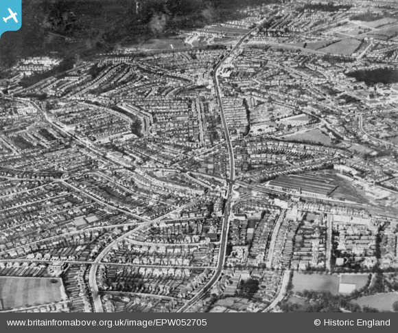
EPW052705 ENGLAND (1937). Finchley Road and environs, Child's Hill, 1937. This image has been produced from a copy-negative.
© Copyright OpenStreetMap contributors and licensed by the OpenStreetMap Foundation. 2026. Cartography is licensed as CC BY-SA.
Nearby Images (7)
EPW052705

EPW008214

EPW008218
 extension from Golders Green to Hendon and Edgware under construction, Child's Hill, 1922. This image has been produced from a copy-negative.")
EPW028180

EPW009095

EPW009535

EPW000810

Details
| Title | [EPW052705] Finchley Road and environs, Child's Hill, 1937. This image has been produced from a copy-negative. |
| Reference | EPW052705 |
| Date | 25-March-1937 |
| Link | |
| Place name | CHILD'S HILL |
| Parish | |
| District | |
| Country | ENGLAND |
| Easting / Northing | 524959, 187667 |
| Longitude / Latitude | -0.19662493099653, 51.573528277192 |
| National Grid Reference | TQ250877 |
Pins

Spaceweed |
Thursday 8th of September 2022 01:24:17 AM | |
|
Spaceweed |
Thursday 8th of September 2022 01:23:22 AM | |
|
Spaceweed |
Thursday 8th of September 2022 01:22:27 AM | |
|
Spaceweed |
Thursday 8th of September 2022 01:21:13 AM | |
|
Spaceweed |
Thursday 8th of September 2022 01:20:05 AM | |
|
Spaceweed |
Thursday 8th of September 2022 01:19:16 AM | |
|
Spaceweed |
Thursday 8th of September 2022 01:18:23 AM |