
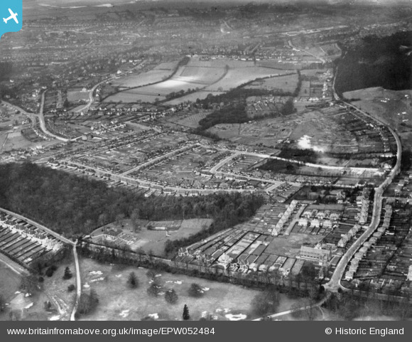
EPW052484 ENGLAND (1937). Housing around Norfolk Avenue and environs, Selsdon, 1937. This image has been produced from a print.
© Copyright OpenStreetMap contributors and licensed by the OpenStreetMap Foundation. 2026. Cartography is licensed as CC BY-SA.
Nearby Images (2)
EPW052484

EPW052489

Details
| Title | [EPW052484] Housing around Norfolk Avenue and environs, Selsdon, 1937. This image has been produced from a print. |
| Reference | EPW052484 |
| Date | 22-February-1937 |
| Link | |
| Place name | SELSDON |
| Parish | |
| District | |
| Country | ENGLAND |
| Easting / Northing | 534304, 162202 |
| Longitude / Latitude | -0.071512675428289, 51.342513787036 |
| National Grid Reference | TQ343622 |
Pins
Be the first to add a comment to this image!